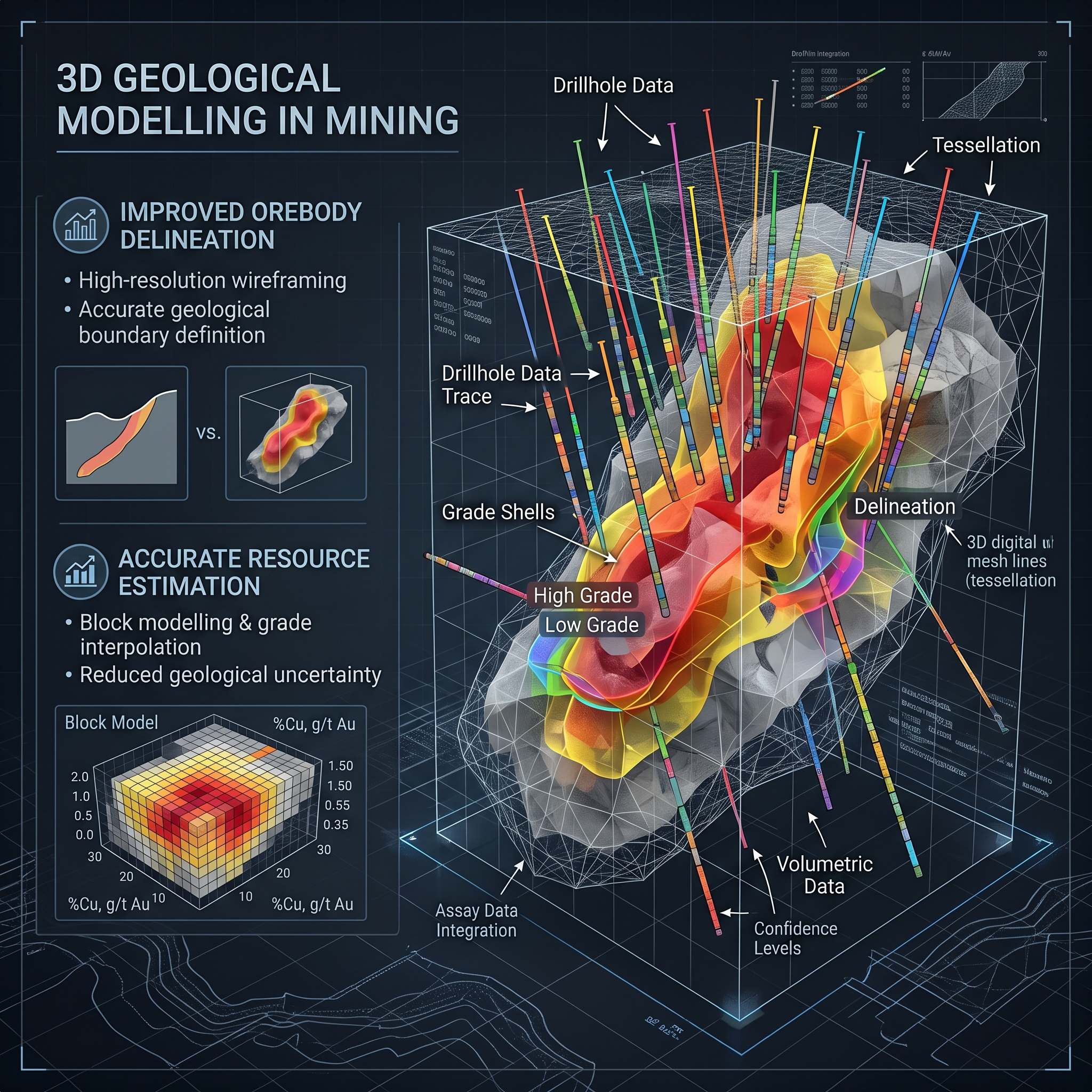


The limitations associated with two-dimensional cross-sections and manual wireframes in understanding the complexity of subsurface geometry are the introduction of human bias and geometric errors into the mine planning process. The use of three-dimensional geological modeling techniques solves the above-mentioned problems through the integration of various exploration data, including diamond drillhole logs, structural mapping, geophysics, and geochemical analyses, into one spatial model. Three-dimensional modeling allows geologists to build a coherent digital representation of heterogeneous mineral deposits. Accurate delineation of boundaries, anisotropic geostatistics, and uncertainty analysis improve the accuracy of mineral resources estimation and minimize financial risks.
A precise definition of ore bodies calls for a shift from traditional manual section correlation into implicit spatial interpolation and classification using machine learning methods like K-Nearest Neighbours (KNN), XGBoost and Artificial Neural Networks. Combination of spatial location (X, Y, Z) and geochemical indicators allows predictive models to detect complex contacts and alteration halos like potassic or propylitic ones. Inclusion of structural controls involving fault zones, shear zones and intrusive dikes ensures that resource domains represent geological reality and not just grade cut-off levels. Domaining in space results in a precise definition of ore vs. waste rock, thus avoiding ore dilution and grade misclassification in the mining process.
Typical geostatistical methods normally assume that spatial correlation remains stationary across the entire deposit, which is not possible when dealing with deposits that have complex structures or are folded. Dynamic anisotropic variography solves this problem by making it possible to orient the search ellipsoid based on the local dip, strike, and plunge direction of wireframe surface meshes. Spatial grade interpolation utilizes both Ordinary Kriging and Inverse Distance Weighting within block models, using composited intervals such as 8-meter drillhole composites to match planned bench heights. Model validation through swath plots and cross-validation shows that block model estimates retain spatial correlation and represent assay trends in all directions.
Subsurface heterogeneity and poor drillhole spacing cause parametric and intrinsic uncertainty that will affect the economic aspects of the project. A small difference of up to 15% in the estimation of grades or tonnage will lead to financial losses, unanticipated changes in the process-plant operations, or termination of the project. Geostatistical conditional simulations like Sequential Gaussian Simulation (SGS) and Multiple-Point Statistics (MPS) generate multiple equiprobable realizations of the deposit to assess variability at local and global levels. The entropy machine learning-based uncertainty mapping helps in determining zones with ambiguous contacts and poor sampling to conduct further infill drillholes. Finally, the resource blocks are categorized as Measured, Indicated, and Inferred depending on their estimation variance and spatial confidence.
The concept of three-dimensional geological modeling brings about a significant revolution in the valuation of minerals by shifting from simple geometry-based estimation to geology-based digital twins, which can change dynamically. The combination of implicit domaining, dynamic variography, and stochastic simulation makes it possible to create realistic and accurate block models about subsurface continuity. This allows mine development teams to achieve better results in terms of optimizing cutoff grades, designing blasts, and predicting finances through ore-waste segregation.