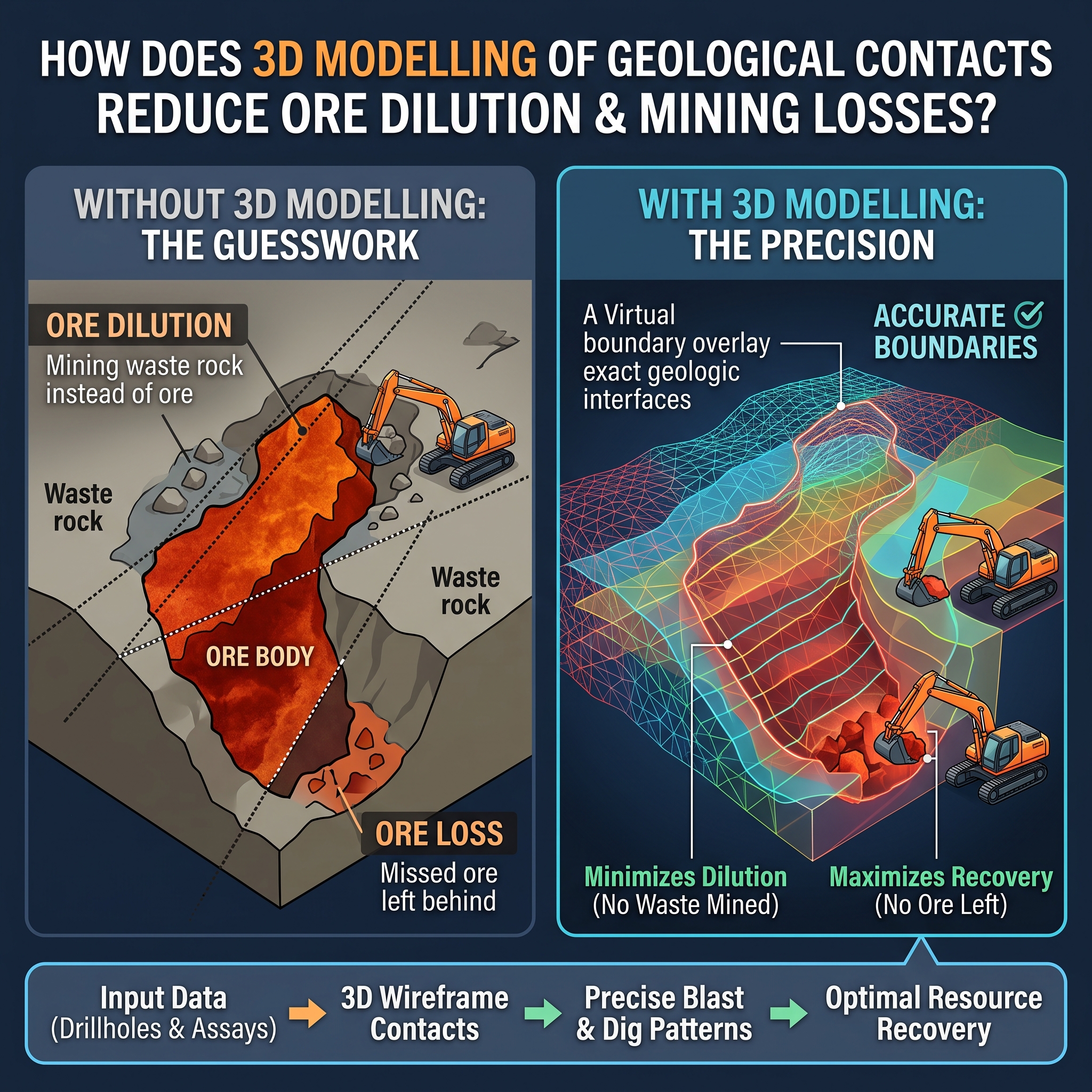


Conventional mine planning makes use of simple 2D cross sections, manual drafting techniques, or fixed dilution factors (e.g., fixed dilution factor of 5–10%), which do not adequately reflect the complexities of the irregular or non-linear geological contact. This leads to the misclassification of ore as waste (ore loss) or waste rock contamination of mined ore (dilution), thus increasing milling costs and lowering head grade. Modern 3D geologic modeling of contact areas impacts conventional mine planning by allowing proper representation of the geometry of the contacts, uncertainty analysis, and optimization of excavation limits to minimize ore loss and dilution.
Advanced 3D implicit and explicit geological modeling techniques that use Radial Basis Functions create dynamic 3D surfaces that accurately reflect complicated lens shapes, pinch-and-swell structures, and sinusoidal contact boundaries. Explicit modeling of rigid 3D lithological domains with hard or soft boundaries reduces grade smearing along waste contacts when interpolating grades. In addition, state-of-the-art mining software can carry out Boolean solid operations by intersecting 3D ore bodies, wall rocks, and mined out voids to determine physical dilution and loss volumes. Such precision modeling dispels all guesswork involved in traditional 2D cross-section techniques.
Geostatistical simulations create several scenarios with the same probability for the three-dimensional analysis that is necessary to identify high-risk areas where dilution is most likely to happen. Boundary optimization approaches like pilot point calibration or bench face angle calculation help define the best way to maintain ore recovery rate while ensuring minimal dilution with waste rock along contacts. The ability to have probabilistic dilution envelopes allows short-term mine planning staff to change the direction of cutting or use selective extraction machines. This will minimize unexpected dilution problems and improve the efficiency of grade control.
Generation of waste and stripping ratios is a basic geological feature determined based on 3D contact geometry, dip, and depth rather than by administrative or cadastral borders. Spatial variography helps determine main anisotropic features that help conduct the extraction of minerals in the same way as the main geological trend rather than following any rigid geometric patterns. The use of 3D contact block models during staged pit optimization and selection mining will ensure the systematic management of contact zones and regions with high stripping ratios. These structural features reduce the risk of significant contamination by rocks.
The transition from static estimates to three-dimensional contact modeling offers mining operations the spatial knowledge necessary to protect mill head grades, cut material handling costs, and conserve minerals. The accurate mapping of boundary shapes, spatial uncertainty management, and alignment of mine design with geological continuity help in the avoidance of dilution and ore losses throughout the lifetime of the mine. Updating the 3D geological model with new information on production and drilling helps maintain the standard of plan-to-actual reconciliation over time.