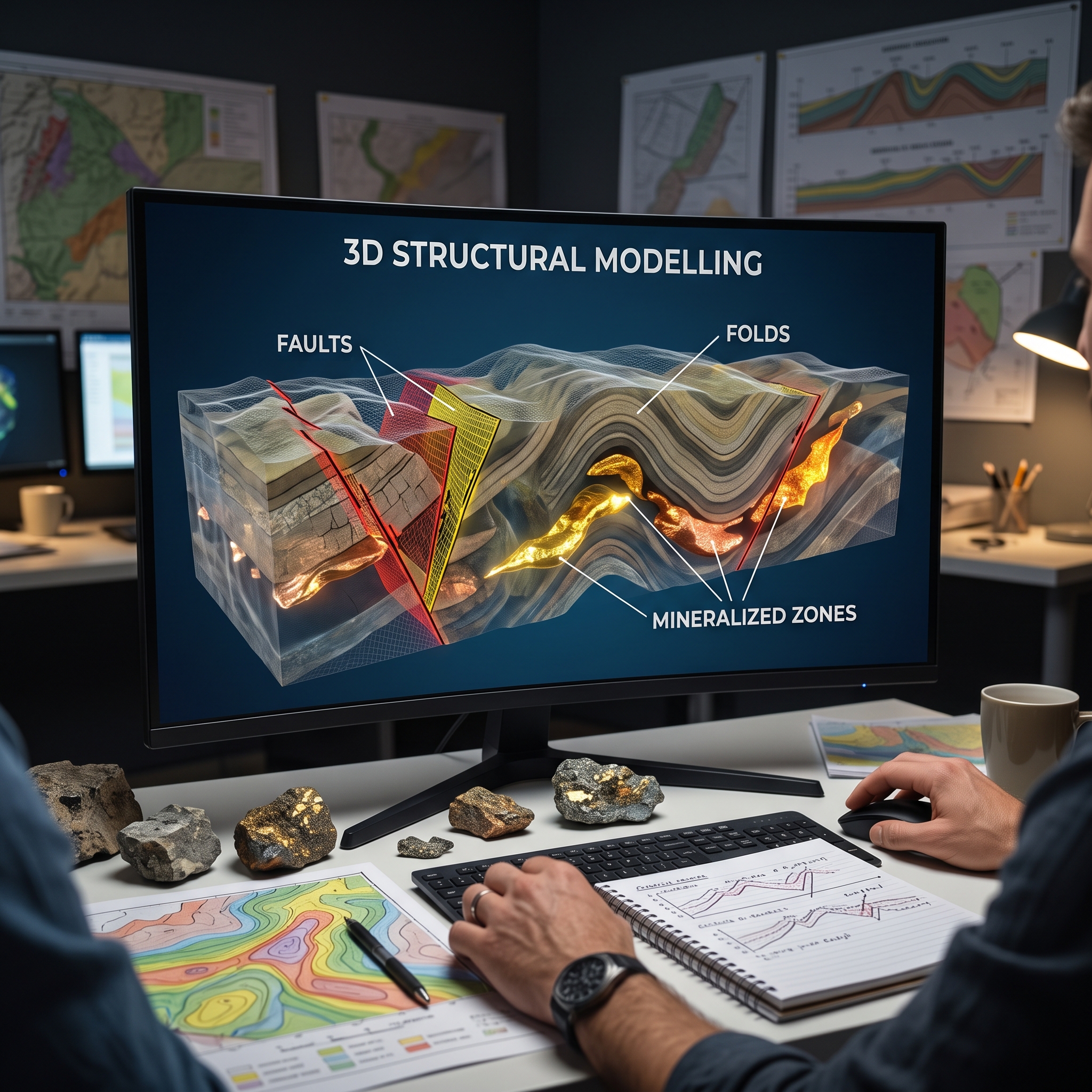


Traditional two-dimensional geological maps and cross-sections struggle to portray complex, polyphase subsurface architectures accurately. Implicit three-dimensional structural modelling addresses this limitation by unifying drill hole logs, surface outcrop mapping, mine level maps, and airborne geophysics into interactive digital volumes. Advanced interpolation algorithms transform discrete spatial observations into continuous structural surfaces and orebody models. This methodology allows geologists to reconstruct fault networks, unravel polyphase folding, and predict deep mineralised zones. Ultimately, digital workflow integration reduces exploration risk, resolves structural ambiguity, and improves target generation across complex tectonic terranes.
Fault systems govern fluid pathways and structural offsets within mineralised terranes. Modern 3D structural modelling integrates airborne aeromagnetic lineaments with drill core marker horizons to establish regional fault networks and imbricate fault duplexes. Advanced kinematic frameworks restore data points to pre-fault positions prior to surface interpolation, preserving displacement directions and overall geometric volume across faulted domains. Unlike conventional step functions that distort scalar fields and artificially shrink volume, kinematic restoration accommodates varying intersection angles between faults and folded host rocks. Furthermore, mapping these displacement vectors clarifies how fault conduits guide hydrothermal fluid flow and post-depositional shear movements throughout geological history.
Polyphase deformation severely complicates stratigraphic correlations and orebody morphology in complex terranes. Mathematical interpolation of bedding foliations, fold axes, and stretching lineations generates three-dimensional structural form-lines that portray complex fold networks. These models illuminate superimposed deformation events, such as asymmetric S-folds refolding earlier Z-folds, drag folds, and doubly plunging synforms. Structural analysis demonstrates how intense deformation creates thickened fold hinges that serve as key structural traps for high-grade ore. In addition, extensional shearing during progressive deformation stretches mineralised horizons into oblate or prolate megaboudins aligned with regional stretching lineations.
Three-dimensional implicit interpolation translates multi-element geochemical assays, lithological core logs, and historic mine plans into continuous solid ore bodies. Spatial interpolation techniques, including Radial Basis Functions, generate ore grade distributions constrained by lithological contacts and expert geological knowledge. High-resolution models highlight mineralisation enriched along granite contact zones, skarn interfaces, and altered fault feeders. The establishment of structural continuity enables the identification of unmined ore extensions and repeated stratigraphic horizons at depth. Consequently, exploration teams can delineate high-priority drilling targets in unexplored sectors far below legacy mining levels.
Three-dimensional structural modelling fundamentally advances subsurface interpretation by converting complex geological observations into explicit spatial frameworks. Geologists accurately resolve fault kinematics, unravel refolded structures, and trace ore grade distributions deep underground. The synthesis of geological constraints with mathematical interpolation reduces structural ambiguity in data-limited environments. As mineral exploration shifts toward deeper hidden deposits, 3D modelling serves as an indispensable tool for unearthing concealed mineral systems and optimizing drill targeting. This technology provides a scalable foundation for modern mineral resource assessment.