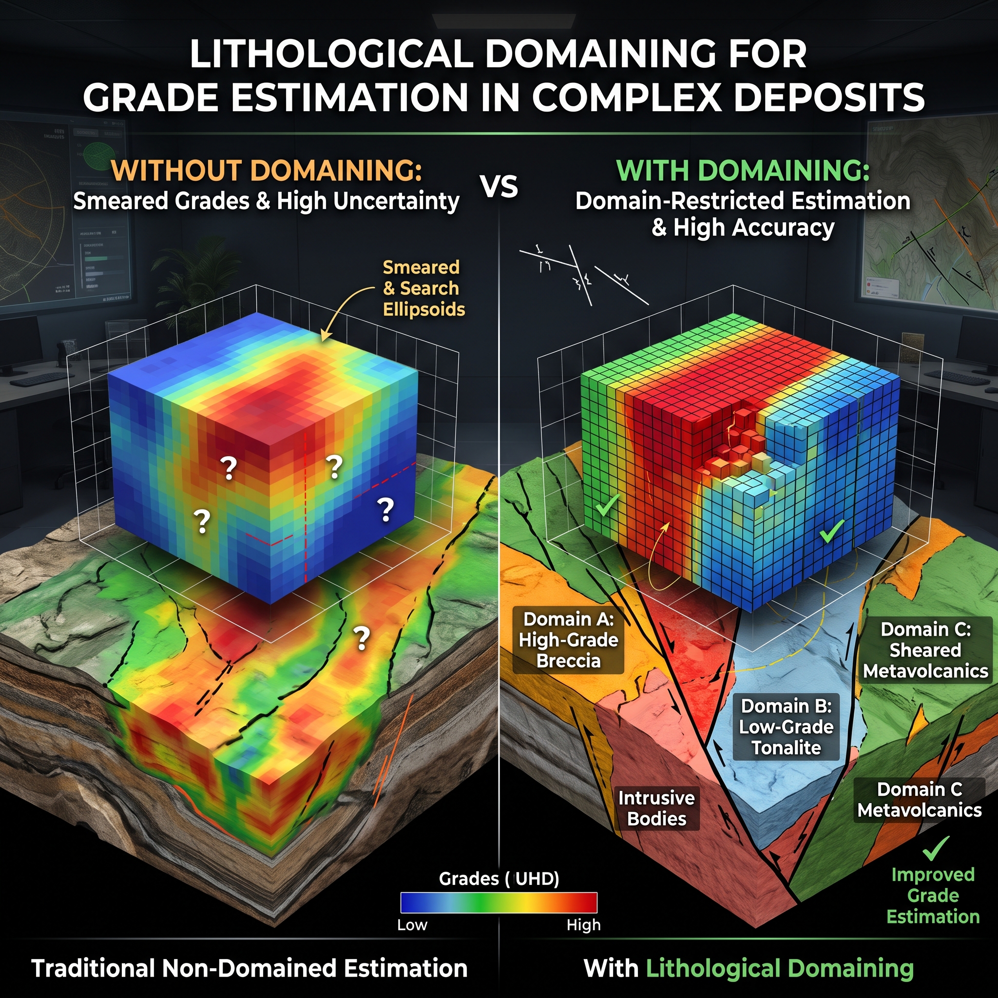


Mineral resource estimates frequently suffer from severe downgrades or reconciliation failures during mining operations. These costly discrepancies often stem from flawed geological modeling prior to numerical grade interpolation. The practice of lithological domaining subdivides a complex mineral deposit into distinct three-dimensional volumes based on host rock lithology, structural architecture, and mineral assemblages. Proper domaining establishes statistical stationarity, controls extreme assay values, and prevents the creation of unrealistic numerical artifacts.
Linear geostatistical interpolation methods, such as ordinary kriging, depend on the fundamental assumption of stationarity. Sample data within an estimation domain must share a consistent statistical population. Complex deposits frequently feature sharp mineralization contrasts between altered host rocks and unmineralized lithologies. Blended data populations create multi-modal grade distributions that violate geostatistical assumptions and introduce severe estimation bias. Spatial restriction of sample weighting within geologically coherent lithological units stops high-grade samples from artificially smearing into barren host rocks. This separation maintains spatial grade boundaries and preserves variogram integrity.
Extreme assay values pose a constant risk of global and local resource overestimation in complex orebodies. Many practitioners rely on aggressive grade capping as a primary solution, but top-cutting can act as an arbitrary band-aid that destroys real metal content. The implementation of lithological domaining provides a primary geological mechanism to constrain high-grade intercepts within their true host units. Quantitative contact analysis determines whether boundaries between lithological units are abrupt or gradational. Hard domain boundaries prevent composited samples from informing blocks across geological contacts, containing extreme values without unnecessary global capping.
Automated software tools often generate unconstrained grade-shells based solely on artificial cutoff thresholds. These models frequently produce unrealistic grade “blobs” that ignore fundamental structural controls and rock geometries. Geologists who combine primary core logging with geochemical proxies, such as portable XRF multi-element data, can delineate realistic host boundaries. This geological framework provides the foundation for advanced techniques like plurigaussian and conditional simulation. The integration of lithological domains reduces spatial uncertainty and produces block models that reflect true subsurface geometry.
The application of lithological domaining serves as an indispensable pillar of accurate mineral resource estimation in complex deposits. Sound geological domains guarantee statistical stationarity, restrict high-grade outlier smearing, and ensure block models honor subsurface geology. Practitioners should combine detailed core logging, multi-element geochemistry, and boundary contact analysis to establish defensible estimation domains.