
Sign In


Forgot Password?

Don't have account, Sign Up Here

Forgot Password

Lost your password? Please enter your email address. You will receive a link and will create a new password via email.


Have an account? Sign In Now

Sorry, you do not have permission to Add a Post, You must login to Add a Post.


Forgot Password?

Need An Account, Sign Up Here

Sorry, you do not have permission to add Article.


Forgot Password?

Need An Account, Sign Up Here

Please briefly explain why you feel this Post should be reported.

Please briefly explain why you feel this Comment should be reported.

Please briefly explain why you feel this user should be reported.

Mining Doc Logo Mining Doc Logo Mining Doc Logo
Sign InSign Up

Mining Doc

Mining Doc Navigation

  • Home
    • About
    • Contact us
  • Mining articles
  • Online Courses
Search
Sign up

Mobile menu

Close
join for free
  • Home
  • Online courses
  • Case study
  • Mining Community
  • Solutions listing
    • Lase Solutions
    • O-PitBlast Solutions
    • Continuous Mining
    • Longwall mining
    • Geosight Scanners
    • LoopX AI
    • Terafil solutions
    • Blasting solutions
    • Geotechnical
    • Submersible Pumps
    • Mine rescue system
    • Ore sorting
    • Whittle Consulting Solutions
  • Add Blog
  • Feed
  • User Profile
  • Posts
    • New Posts
    • Trending Posts
    • Must read Posts
    • Hot Posts
  • Polls
  • Badges
  • Home
    • About
    • Contact us
  • Mining articles
  • Online Courses

Mining Doc Latest Posts

Mining Doc
  • 0
  • 0
Mining DocBeginner
Added: September 9, 20262026-09-09T05:47:58-04:00 2026-09-09T05:47:58-04:00In: Mining Industry Research

What's the latest research consensus on using hyperspectral drone surveys to reduce exploration drilling costs?

  • 0
  • 0

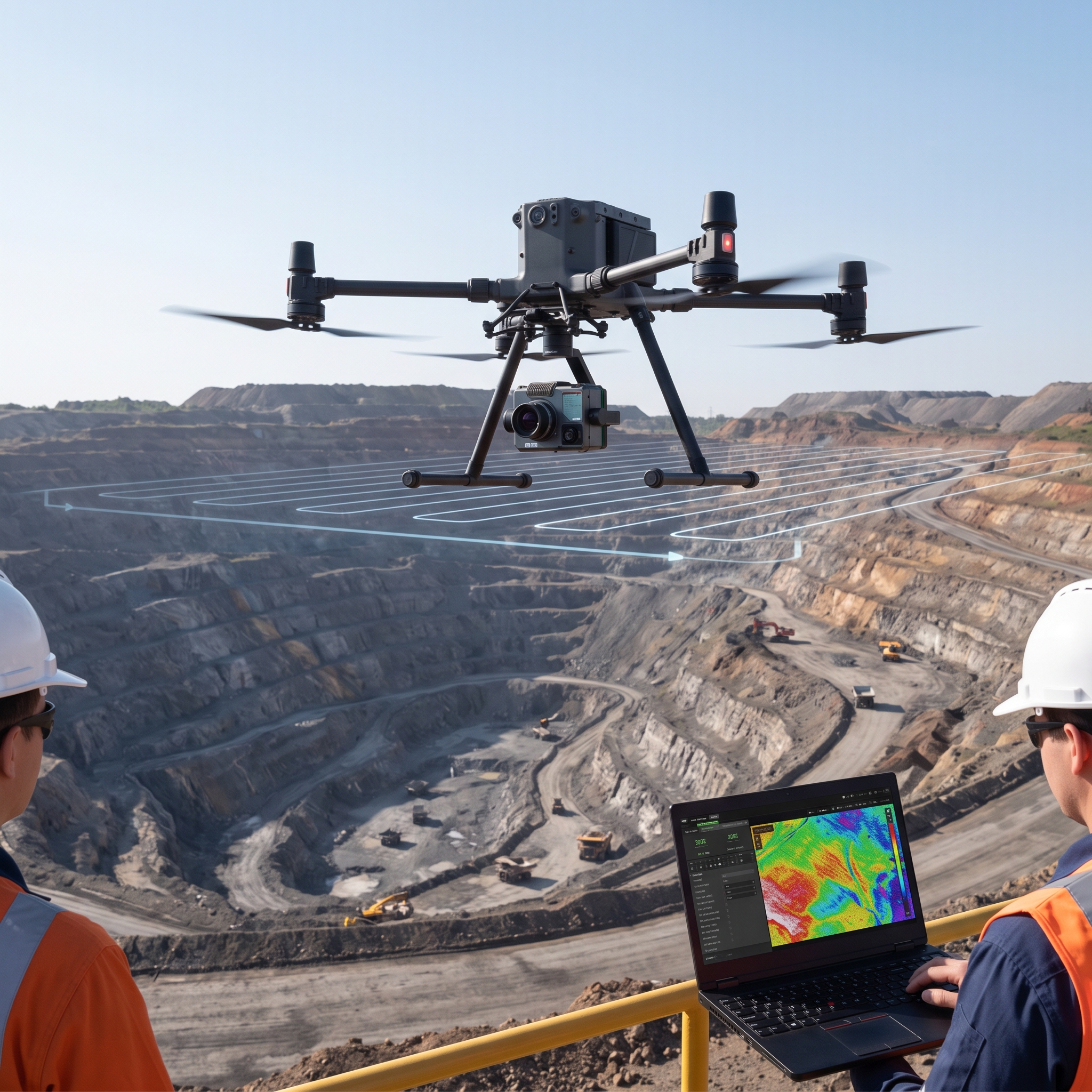
Mineral exploration is becoming an activity increasingly based on drilling. It is a very costly process that is crucial for the profitability of subsurface resources exploitation. To compensate for the huge expenses associated with drilling, the industry increasingly uses advanced remote sensing techniques. The two key notions in this context are Uncrewed Aerial Vehicles (UAV) and hyperspectral imaging (HSI). UAV technology allows placing highly maneuverable low-altitude deployment systems, and HSI allows acquiring electromagnetic spectra across hundreds of narrow wavebands which enables material identification due to distinctive spectral signatures.

UAV-based HSI provides geologic targeting capabilities by remotely sensing hydrothermal alteration zones. Some minerals show certain reactions to light in particular wavelengths in the visible, near-infrared and shortwave infrared (VNIR-SWIR) ranges. Analyzing such wavelengths allows geologists to create the map of indicator minerals, including white micas and clays, with centimeter resolution (Koerting et al., 2024). Hyperspectral sensors analyze the vibrational properties of molecules bonds in rock-forming minerals, making it possible to discover potential zones of ore concentration using HSI without the help of ground sampling.

Nowadays, there is a common scientific opinion that drone-borne HSI technology is essential to create the connection between broadscale satellite imagery and localized ground data. Satellites provide a large coverage of the Earth but their relatively low resolution cannot reveal structural elements necessary for drilling. At the same time, drones can work at altitudes where it is possible to collect data with high resolution and to keep a safe distance from the ground (Dadrass Javan et al., 2024). Scientists claim that the use of drones equipped with hyperspectral sensors helps to fill this gap and create alteration maps with scales relevant for exploration.

The use of drones equipped with hyperspectral sensors will have a considerable effect on drilling expenses. Taking into account that exploration boreholes require the largest amount of expenditures, the drilling of barren ground causes great financial costs. According to the scientific literature, UAV hyperspectral surveys help geologists to detect zones without mineralization early and optimize drilling plan (Koerting et al., 2024). By improving the geological model before the mobilization of the rig, companies can lower the dry-hole rates significantly.

It is worth mentioning that the cost-saving effect increases considerably when HSI data are combined with geophysical sensors. The integration of high-resolution HSI with drone-borne magnetic survey helps to develop reliable prospectivity models (Jackisch et al., 2019). Using modern computational tools, it is possible to analyze the huge volume of data quickly and make real-time decisions. As workflows develop, the correlation of surface hyperspectral signature collected by drones with subsurface scan of drill core creates highly reliable predictive models (Thiele et al., 2024).

To sum up, the use of hyperspectral drones surveys for mineral exploration represents a revolution in terms of cost-effectiveness. With the help of hyperspectral sensors, it is possible to map alteration zones in a precise way and connect satellite observations with ground works. The scientific opinion regarding the use of UAV-based hyperspectral imaging confirms its significant reduction of blind drilling and probing barren ground.

References

Dadrass Javan, F., Samadzadegan, F., Toosi, A., & van der Meijde, M. (2024). Unmanned Aerial Geophysical Remote Sensing: A Systematic Review. Remote Sensing, 17(1), 110. https://doi.org/10.3390/rs17010110

Jackisch, R., Madriz, Y., Zimmermann, R., et al. (2019). Drone-Borne Hyperspectral and Magnetic Data Integration: Otanmäki Fe-Ti-V Deposit in Finland. Remote Sensing, 11(18), 2084. https://doi.org/10.3390/rs11182084

Koerting, F., Asadzadeh, S., Hildebrand, J. C., et al. (2024). VNIR-SWIR Imaging Spectroscopy for Mining: Insights for Hyperspectral Drone Applications. Mining, 4, 1013–1057. https://doi.org/10.3390/mining4040057

Thiele, S. T., Kirsch, M., Lorenz, S., et al. (2024). Maximising the value of hyperspectral drill core scanning through real-time processing and analysis. Frontiers in Earth Science, 12. https://doi.org/10.3389/feart.2024.1433662
What's the latest research consensus on using hyperspectral drone surveys to reduce exploration drilling costs?
0
  • 0 0 Comments
  • 1 View
  • 1 Reaction
  • 0 Followers
  • 0
    • Report
  • Share
    Share
    • Share on Facebook
    • Share on Twitter
    • Share on LinkedIn
    • Share on WhatsApp

Related Posts

  • What does recent geomechanical research reveal about pillar failure prediction in deep room-and-pillar mines?
  • What do recent studies reveal about bioleaching viability for low-grade copper and gold ores?
  • What does recent research on rockburst prediction models reveal about deep-mine seismic risk management?

You must login to add an Comment.


Forgot Password?

Need An Account, Sign Up Here
aalan

Sidebar

Sponsored Ads

aalan
  • Recent
  • How Can Mine Construction Teams Reduce Rework During Fast-Track Projects?
    • On: September 8, 2026

    How Can Mine Construction Teams Reduce Rework During Fast-Track Projects?

  • The Mine in Your Pocket: Why Mobile ERP Is Reshaping Mining Operations
    • On: September 8, 2026

    The Mine in Your Pocket: Why Mobile ERP Is Reshaping ...

  • How Concrete Is Used in Crusher and Screening Plant Foundations at Guatemalan Mines
    • On: September 4, 2026

    How Concrete Is Used in Crusher and Screening Plant Foundations ...

  • Portable Crusher Plant for Hard Rock Mines: How to Design the Crushing Circuit Before Grinding
    • On: September 3, 2026

    Portable Crusher Plant for Hard Rock Mines: How to Design ...

  • From Data to Decisions: Why Mining Intelligence Is the Next Competitive Advantage
    • On: September 1, 2026

    From Data to Decisions: Why Mining Intelligence Is the Next ...

  • How Thermal Imaging Security Cameras Are Improving Safety at Mine Sites
    • On: September 1, 2026

    How Thermal Imaging Security Cameras Are Improving Safety at Mine ...

  • Why Is a Professional Aggregate Crushing Solution More Important Than Purchasing a Single Piece of Equipment?
    • On: September 1, 2026

    Why Is a Professional Aggregate Crushing Solution More Important Than ...

Go to Home page to view more

Top Members

Olena Skyba

Olena Skyba

  • 150 Posts
  • 2 Comments
Pundit
Marcial

Marcial

  • 91 Posts
  • 0 Comments
Enlightened
Jean Marais (Sanodea Group)

Jean Marais (Sanodea Group)

  • 26 Posts
  • 0 Comments
Beginner
Trending on Mining Doc

Trending Communities

Fixed Plant General Information Geology Mining Case Studies Mining Doc Documentary Mining Engineering Mining Events Mining Finance and Economy Mining Human Resources Mining Industry Research Mining Operations Mining Software Solutions Mining Sustainability Mining Technology Solutions Mobile Plant Equipment

Explore

  • Home
  • Online courses
  • Case study
  • Mining Community
  • Solutions listing
    • Lase Solutions
    • O-PitBlast Solutions
    • Continuous Mining
    • Longwall mining
    • Geosight Scanners
    • LoopX AI
    • Terafil solutions
    • Blasting solutions
    • Geotechnical
    • Submersible Pumps
    • Mine rescue system
    • Ore sorting
    • Whittle Consulting Solutions
  • Add Blog
  • Feed
  • User Profile
  • Posts
    • New Posts
    • Trending Posts
    • Must read Posts
    • Hot Posts
  • Polls
  • Badges

Footer

Mining Doc

Join our community and connect with other people in the Mining industry for knowledge sharing.

Legal Stuff

  • Privacy Policy
  • Terms of Service

Help

  • Support
  • FAQs
  • How to add new content and how to promote a content
  • Compliance and guidelines
  • Subscribe to Mining Doc

Follow

© 2026 Mining Doc. All Rights Reserved