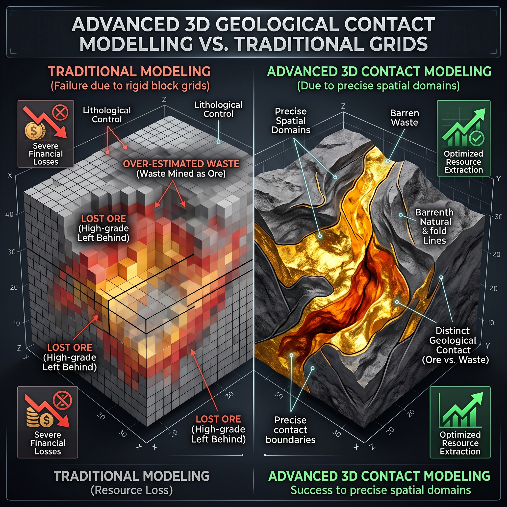


Mineral extraction operations regularly face severe financial losses when routine resource estimation fails to map exact geological boundaries between economic ore and barren waste rock. Traditional estimation models often depend exclusively on numerical grade cut-offs or rigid block grids, which smooth sharp transition zones and obscure key lithological controls. Advanced 3D geological contact modelling addresses this challenge by establishing precise spatial domains prior to metal grade interpolation.
Clear technical definitions frame the evaluation of subsurface domain boundaries:
- 3D geological contact modelling: the process of constructing explicit or implicit three-dimensional representations of lithological, structural, and mineralisation boundaries using drill-core logging, mapping, and geostatistical algorithms.
- Ore dilution: the proportion or percentage of non-economic waste material mixed with valuable ore during extraction and delivered to the processing facility. Dilution manifests in three main forms: internal dilution (waste inclusions inside the orebody or grade smoothing over fixed block volumes), geologic contact dilution (boundary mixing caused by block geometry spanning contact lines), and external dilution (overbreak, blast movement, and excavation errors outside designed ore limits).
- Ore extraction losses: the volume of valuable economic ore mistakenly classified as waste and sent to waste dumps or left unextracted in the ground due to poor boundary resolution.
Boundaries constructed purely from grade cut-offs introduce substantial misclassification errors. Contact domain analysis demonstrates that many orebodies exhibit hard boundaries where metal grades drop abruptly across lithological contacts. When resource models ignore these abrupt geological transitions, mathematical algorithms artificially smear high grades into adjacent barren rock and low grades into rich ore zones.
Hierarchical stochastic contact modelling resolves this error by simulating categorical geological domains before estimating grades within each isolated domain. Comparative mine studies demonstrate that joint simulation of domain boundaries and metal grades yields significantly higher correct classification ratios between ore and waste blocks than unconstrained models. This structured domaining approach ensures statistical stationarity within estimation units and prevents artificial boundary smoothing.
Subsurface deposits frequently feature complex structural discontinuities, including fault displacements, seam splitting, folding, and pinch-outs. Modern implicit modelling algorithms convert drillhole picks and field mapping directly into realistic three-dimensional solids without generating artificial geometric anomalies. These explicit contact surfaces provide dynamic updates as new exploration assays arrive.
Fixed rectangular block models inevitably force boundary blocks to cross true contact surfaces, creating inherent geometric contact dilution. High-resolution 3D contact surfaces allow mining engineers to code sub-blocks accurately, adjust bench heights, and design optimized selective mining units. Consequently, excavation equipment can follow true geological contacts during active extraction.
Uncontrolled dilution severely impairs mine profitability by reducing head grades sent to the processing mill. Treatment of excess waste consumes mill grinding capacity, escalates energy and reagent costs per unit of recovered metal, and reduces total metallurgical recovery. In marginal deposits, minor dilution can depress average block grades below economic cut-off thresholds, turning profitable ore blocks into net financial liabilities.
Rigorous spatial reconciliation links long-term resource predictions with short-term grade control data and production receipts. Incorporation of detailed 3D contact surfaces into primary block models minimizes discrepancies between planned reserve tonnages and actual blast-hole assay samples, stabilizing economic forecasts and protecting project net present value.
3D geological contact modelling represents a foundational mechanism for controlling ore dilution and mitigating mining losses. Delineation of true lithological boundaries prior to metal grade interpolation enforces stationarity within estimation domains and eliminates artificial grade smoothing across sharp boundaries. The adoption of geology-driven contact models over generic rule-of-thumb dilution allowances safeguards project economics, improves plant feed quality, and establishes robust long-term mine plans.