This line is vital since it forms the natural and economical line that distinguishes the part of the deposit that can be exploited at a profit from that which needs to remain undisturbed or moved to a waste dump. The precision of the contact will affect the amount of ore, dilution, recovery, mining operations, and reserves estimation.
Firstly, this contact is relevant due to the fact that it determines whether the minerals are considered ores or wastes in estimating resources and reserves. The erroneous placement of the contact results in an incorrect estimation of the reserves and the mining operation plan.
Secondly, this line is important as it influences operations since the ore near this contact may go to waste, and moving the waste along with the ore leads to dilution.
As regards the environment and waste management, the boundary determines the proportion of materials designated as waste rock as opposed to those that need to be managed, stored, and rehabilitated. The geological and mineralogical nature of the ore body affects the environmental performance of wastes, and hence misclassification may lead to impacts other than production losses.
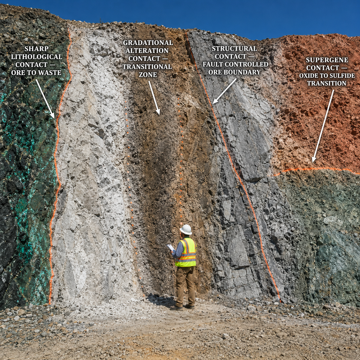
In many ore bodies, the boundary is not clearly defined. There are some ore bodies with sharp boundaries between ore and waste, whereas others possess soft or transitional boundaries.
Field determination
When working on-site, the contact between the orebody and waste can be found by using geological observations and sample data. This is achieved by identifying differences in the rock types, textures, altered zones, minerals, structures, sulfides, oxidations, and other attributes associated with mineralization.
Among the sources of boundary data, the drilling holes are probably the most significant. Geological contacts are detected from core samples, assaying results, and the depth at which the mineralized rocks become barren or below the cutoff point; this information is then used for cross-sectional drawings and solid modeling.
In underground mines and some open-pit operations, detailed mapping can be done at the face and development drives. If the contact represents a change in a physical property, geophysical well logs of density or electrical conductance can be used to identify the contact.
Interpretation limits
Contact determination is always an interpretation and never merely a measurement. Contact position varies based on sampling interval, assay backing, cut-off grade, complexity of structure, and the nature of the boundary (hard vs soft) in the geologic model.
If drilling density is low, there will be substantial uncertainty associated with the ore-waste boundary and must be accounted for in the modeling process. In such instances, geologists might utilize distance-to-contact techniques, block models, and contouring of the zero boundary point in 2D and 3D space.
The ideal scenario involves incorporating geology, assays, geostatistics, and mine exposure data followed by updating the interpretation upon receiving additional information. This would ensure more confidence in the reserve estimation and facilitate mining nearer to the actual boundary with minimum waste and maximum ore recovery.
In summary, the ore-waste boundary is the critical line that defines the integrity of a mine economically and technically: determining both the materials that can be mined and the amount of value recovered.