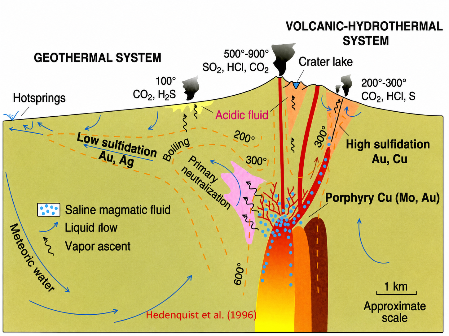


Porphyry Cu-Mo systems represent large-scale, low-grade magmatic-hydrothermal deposits providing most of the world’s supply of copper (Cooke et al., 2014). One of the characteristics that distinguish these deposits from each other is an “alteration mineralogy,” or alteration of minerals of host rocks with the involvement of hot metal-rich fluids. The method of finding valuable deposits based on systematic changes in minerals is known as “vectoring.” Alteration zonation is important for vectoring because the economic core of these deposits is usually hidden under barren rocks or thick sedimentary overburden (Asadzadeh et al., 2024).
The vectoring technique depends on the predictable thermal and chemical gradient that exists in the vicinity of a cooled body of magma. As the mineralizing fluids move outwards, their temperature decreases and interacts with the wall rock to create concentric zones characterized by different mineral suites (Asadzadeh et al., 2024). These zones help geologists determine the temperature and distance of the fluids from the magma source. The relationship between these zones is consistent in that they always follow the order of distal propylitic, intermediate argillic, and proximal potassic (Cooke et al., 2014).
The propylitic alteration zone forms the outermost halo, covering a distance of a few kilometers from the mineralized center. It forms in a relatively cooler environment and is known to be made up of chlorite, epidote, calcite, and albite (Pacey et al., 2020). Although not economically enriched, the “green rocks” environment can still serve the purpose of exploration very well since modern technologies have shown that traces of minerals like chlorite and epidote decrease in quantity with a certain mathematical pattern closer to the heat source (Pacey et al., 2020).
Moving inside, the argillic and phyllic zones mark a transition from the green to white environment as the fluid acidity becomes more prominent. Argillic alteration is known to contain clay minerals such as kaolinite, and the phyllic alteration is known for its quartz, sericite, and pyrite (Cooke et al., 2014). The argillic and phyllic zones often overlay both the inner and outer environments because the latter is influenced by the late-stage infiltration of cooler and acidic meteoric water.
The potassic alteration zone is part of the core of the porphyry system that occurs proximally to the causative intrusion and consists of the secondary biotite, potassium feldspar, and magnetite (Cooke et al., 2014). Most importantly, it is in this zone that the highest grade of chalcopyrite and molybdenite, the ore minerals, is hosted. The goal of vectoring is thus in the ability to recognize potassic alteration because this zone defines the location of economic copper and molybdenum deposits.
Ultimately, the importance of alteration mineralogy in porphyry Cu-Mo systems comes from its role of a multidimensional geological map. Since the economic core is a very small part of the overall footprint created by hydrothermal activity, blind exploration drilling is highly ineffective. Through the analysis of the different indicators of alterations, geologists are able to vector towards concealed ores (Asadzadeh et al., 2024).
Image rights: Earh Science Australia (Available here: https://earthsci.org/mineral/mindep/phor_dep/por_dep.html)
References
Asadzadeh, S., Zhou, X., & Chabrillat, S. (2024). Assessment of the spaceborne EnMAP hyperspectral data for alteration mineral mapping: A case study of the Reko Diq porphyry Cu Au deposit, Pakistan. Remote Sensing of Environment, 314, 114389. https://doi.org/10.1016/j.rse.2024.114389
Cooke, D. R., Hollings, P., Wilkinson, J. J., & Tosdal, R. M. (2014). Geochemistry of Porphyry Deposits. Treatise on Geochemistry, 357–381. https://doi.org/10.1016/b978-0-08-095975-7.01116-5
Pacey, A., Wilkinson, J. J., & Cooke, D. R. (2020). Chlorite and Epidote Mineral Chemistry in Porphyry Ore Systems: A Case Study of the Northparkes District, New South Wales, Australia. Economic Geology, 115, 701–727. https://doi.org/10.5382/econgeo.4700